

Notes diverses, et Quelques détails sur Naples
A captain in the Royal Navy under the Empire and the Restoration, Reverseaux was made a count by King Charles X in 1829, notably in recognition of his services during the Greek War of Independence. Over the course of his career the sailor also saw service in the West Indies, at Saint-Domingue, at Antwerp during the siege of the citadel (1832), at Naples, in Corsica, in Barbary (Algiers and Tunis), in Syria, during the Algiers expedition, and in the seas of the Levant.
The table of contents at the beginning of the notebook lists notes on treatises of navigation as well as some of a historical nature, and closes with a large section devoted to Naples.
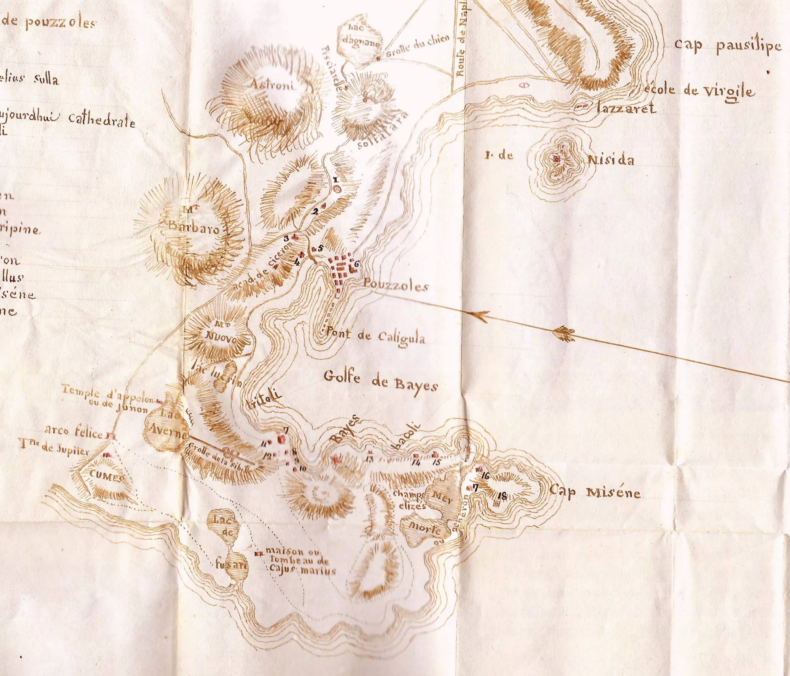
This section on Naples and its surroundings (pp. 120–227), written “in the form of a journal” (and informed by his reading of guidebooks), covering 9 February to around 21 March 1816, is the most substantial and the most interesting part of the manuscript. He calls on the Comte de Narbonne, the Comte de Préville, Major General of the Navy, General Danero, commander of the Navy, the Comtesse de Blacas, and the consul general, while visiting several famous sites and monuments: the chapel of San Severo in Naples, the town of Portici, the grottoes of Posillipo and Cumae, Naples Cathedral, the Solfatara, Pompeii, Herculaneum and Vesuvius: “The astonishment I felt on first seeing such a spectacle had banished all thought of danger, but on my way back, once I had returned to the top of the crater, I was not sorry to leave this molten lava and these places, made highly dangerous by the flying stones, flame and smoke.”
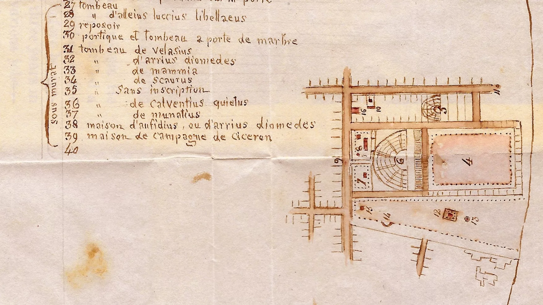
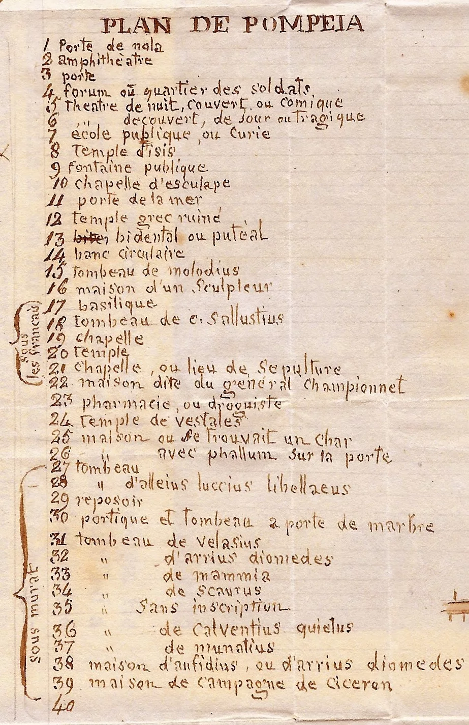
The Comte de Reverseaux also drew, in pen, two folding maps with captions, placed at the end of the volume: a map of the coast from Cape Posillipo to Cumae, and a plan of Pompeii indicating the excavations made “under the French” and “under Murat.”
Contents of the manuscript in detail:
pages 1 to 27: “Observations sur la manière de commander un quart à la mer”;
pages 28 to 32: “Manière de remplacer son gouvernail perdu à la mer”; pages 33 to 34: “Tyran d’eau du Vau L’Auguste” and “la Goëlette La Bacchante”;
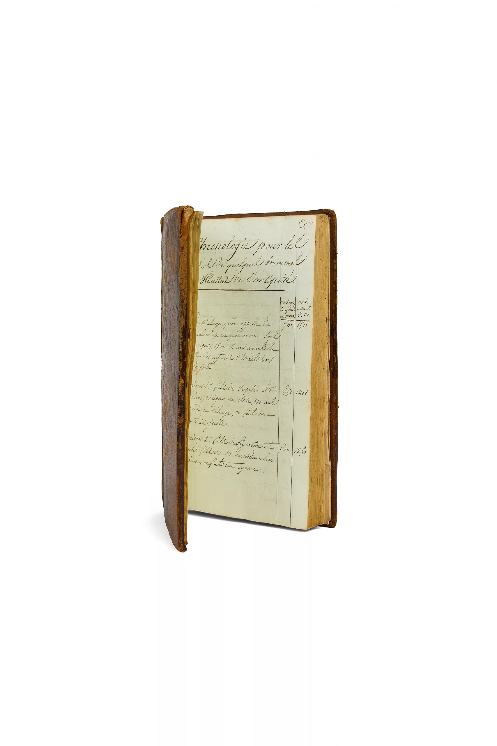
pages 35 to 70: “Chronologie de quelques hommes illustres de l’Antiquité” and “Description de l’Homme a son dernier moment”;
pages 72 to 82: “Louis XIV et les hommes les plus illustres de son siècle, morceau extrait d’un discours de l’abbé Maury”;
pages 82 to 90: “M de M. de B… pour connaître la stabilité d’un bâtiment”; “Méthode pour changer une b. d’.”; “Méthode pour changer un mât d’…”; “Table des corrections à faire pour connaître l’heure des marées”; “Heures de l’établissement des différents ports”;
pages 92 and following: “Aperçu sur les figures de la langue française”; “Quelques détails sur Naples et ses environs”; “Dimension du gouvernail d’un vaisseau”; “Pensées détachées”; “Des exagérations d’un voyageur”; “Elvire, anecdote”; etc.